As India prepares for its next Census, should it revise its current methodology for defining and measuring urbanisation to better reflect the country’s changing socioeconomic realities and spatial growth patterns?
-
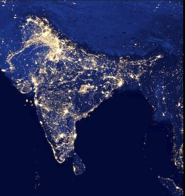
As per the 2011 Census, only 31.2% of India’s population is classified as urban, based on a definition set in 1961 that distinguishes statutory and census towns through demographic and economic criteria. However, evolving settlement patterns and economic shifts suggest that this significantly underrepresents India’s true urban scale. The World Bank’s Agglomeration Index estimates urban-like conditions for over 55% of the population, pointing to substantial “hidden urbanization.” As India approaches its next Census, redefining ‘urban’ is critical to enable accurate planning, equitable resource distribution, and responsive governance.
-
A ashaysamarth_k5wu marked this post as a regular post on
-
A ashaysamarth_k5wu marked this post as a question on
-
- The rigid Census Town criteria should be updated to include indicators like access to urban services, land use patterns, and satellite-based proxies such as night-time lights. Use of online dashboards to keep a track of such services.
- Integrating remote sensing and GIS data would allow real-time tracking of urban sprawl beyond the 10-year census cycle. Digipin can be helpful in this direction.
- Introducing a new category like “transitional towns” or “urbanising areas” would help formally acknowledge regions in flux.
- Harmonising urban definitions across ministries—Census, Urban Affairs, Panchayati Raj—would reduce policy inconsistencies.
- The Census should also incorporate mid-decade urban updates or rolling surveys, supported by digital tools and citizen engagement.
- Consultation with state government and local planning bodies for verifying urban transitions on the ground.
- A provision should be added to remove the status of urban area in case they fail to provide basic amenities like access to potable water, toilets etc.
-
P pcmc_admin1 has marked this post as solved on